Search
02 May 2024
Search
02 May 2024
Please allow ads as they help fund our trusted local news content.
Kindly add us to your ad blocker whitelist.
If you want further access to Ireland's best local journalism, consider contributing and/or subscribing to our free daily Newsletter .
Support our mission and join our community now.
To continue reading this article, you can subscribe for as little as €0.50 per week which will also give you access to all of our premium content and archived articles!
Alternatively, you can pay €0.50 per article, capped at €1 per day.
Thank you for supporting Ireland's best local journalism!

Anne-Karoline Distel - surveyor at work! / Picture: Nicholas Maher

A concise street-level imagery survey of Kilkenny City has now been completed by Kilkenny resident and volunteer mapper Anne-Karoline Distel.
The 360° imagery taken with a GoPro Max sponsored by Meta was uploaded to mapillary.com where it is available for anyone to use.
The camera and other equipment was provided by Meta in a European grant of 10 cameras of which the others went to France, Italy, Serbia, Croatia, Latvia and other European countries.
Meta, which owns Facebook and Mapillary, is hoping that the volunteer surveyors will capture areas not accessible by cars, but mostly by pedestrians and cyclists.
During the uploading process, faces and licence plates are blurred to ensure privacy.
Using AI, Mapillary can then find traffic signs like speed limits and add them to OpenStreetMap which is in turn used by sat nav apps like TomTom or OSMAnd.
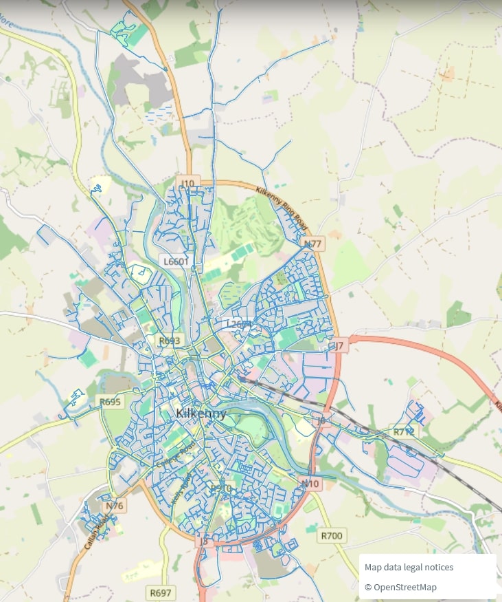
[Picture: Screenshot of mapillary.com showing the extent of the survey / © OpenStreetMap]
The EU camera project is organized by OpenStreetMap Belgium.
The thousands of volunteer OpenStreetMap mappers all over the world use Mapillary imagery to remotely map street furniture like street lights, street cabinets, benches and fire hydrants, but also defibrillators, the number of building levels, roof shapes and material or the presence of solar panels, trees or bus stops (where they are signposted).
GoogleStreetView cannot be used for these tasks, because it is licensed and may only be used by Google for creating their maps.
This survey took Anne with her helmet-mounted camera just over three weeks during which she cycled and walked around every street and all accessible housing estates and parks.
She was inspired by mapper Stephane who captured all the streets of Brussels within 18 months during the Covid lockdown.
“Hearing about Stephane’s project, I was convinced I could cover all of Kilkenny and had started with an older 360° camera,” she said.
“The GoPro Max gave me extra motivation to finish the project, even though it meant that I had to start all over again for a consistent image quality.
“Meta hasn't given me a schedule; this is all voluntary work, so I can cover as much or as little as I like. But being German, I like to be thorough and efficient, and apart from that, I enjoy exploring the country and literally putting everything on the map.”
This street level imagery covers even the newest housing estates like Fox Meadow and Nyne Park.
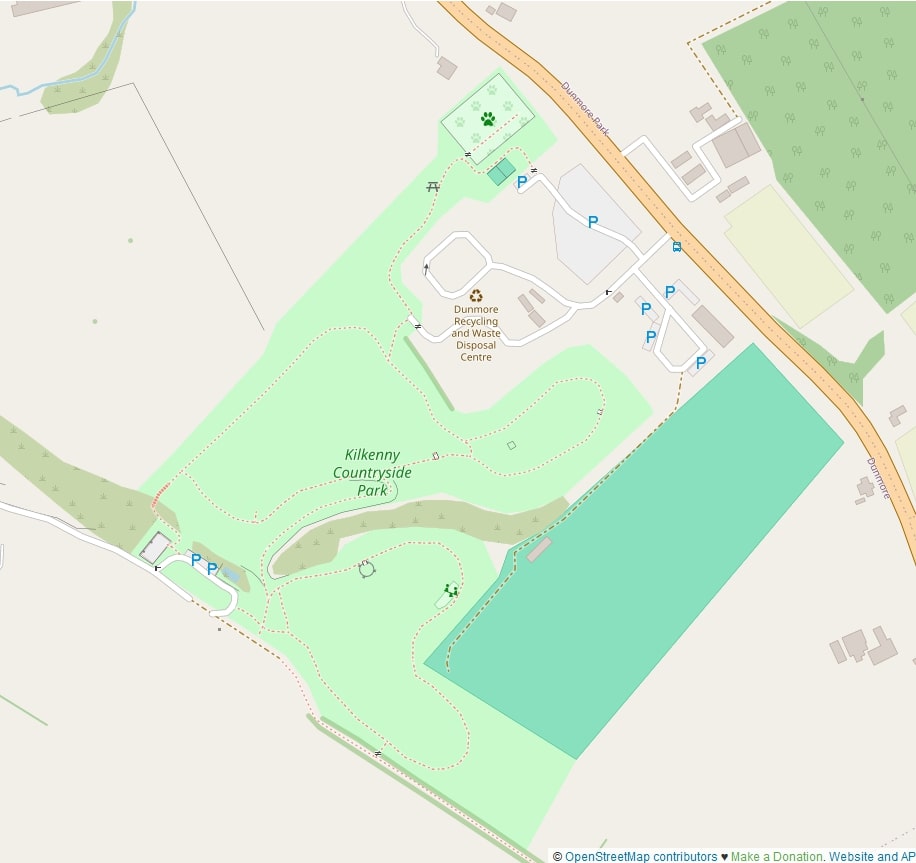
[Picture: The Countryside Park was part of the survey and should now be mapped fairly well with all amenities / © OpenStreetMap]
While out and about on the bike, Anne ensured that all the new addresses were added to OpenStreetMap as well.
“Many people don't know how many companies and institutions now rely on free and good address and map data which is provided by OpenStreetMap.org,” she explained.
“Daft.ie, Met Éireann, TomTom, Amazon Prime and Facebook are just a few that people might recognize.”
Having up-to-date maps is especially important in new housing estates.
“I talked to a resident in Fox Meadow who said they had great difficulty with the delivery vans finding their address,” she said.
“The problem is that eircodes only work if the street or road leading to the eircode is mapped, unless the delivery is by drone.”
The decentralised approach of crowd sourced mapping is essential for keeping maps and map data free and up to date.
“I always keep an eye on the Kilkenny People to get information about opening and closing businesses and construction sites,” Anne added.
“But ground truth is vital for good map data which is only viable with local mappers.”
Anne, who does not drive, hopes to cover some of the smaller towns in the county, provided they can be reached by public transport and the bus timetable leaves enough time for a thorough survey.
If you'd like to see the fruits of Anne's labour, you can explore Mapillary by CLICKING HERE.

Subscribe or register today to discover more from DonegalLive.ie
Buy the e-paper of the Donegal Democrat, Donegal People's Press, Donegal Post and Inish Times here for instant access to Donegal's premier news titles.
Keep up with the latest news from Donegal with our daily newsletter featuring the most important stories of the day delivered to your inbox every evening at 5pm.
This publication supports the work of the Press Council of Ireland and Office of the Press Ombudsman, and our staff operate within the Code of Practice of the Press Council. You can obtain a copy of the Code, or contact the Council, at www.presscouncil.ie, Lo-call 1800 208 080 or email: info@presscouncil.ie.


